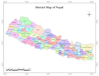
District Map of Nepal :
Nepal is a landlocked country in South Asia sharing its borders with China in the north and India on three other sides. The country is separated from Bangladesh by the Indian Siliguri Corridor. The Indian state of Sikkim separates Nepal from Bhutan. Located in the Central Himalayas, Nepal is home to the Mount Everest, world's highest mountain. The country lies between latitudes 26° and 31°N, and longitudes 80° and 89°E and has an area of 147,181 square km (56,827 sq. mi). Nepal is also one of the world's most earthquake-prone regions.


